BC’s Golden Triangle, Canada
Aben’s Forrest Kerr Gold Project is located in the heart of BC’s Golden Triangle in northwestern British Columbia, Canada. The consolidation of three historic claim groups and additional new tenures assembled in July 2016, Aben Minerals has acquired 100% interest on the 23,397-hectare property. Surrounding the project are notable mineral deposits and producing mines including Brucejack, Eskay Creek, Snip, Galore Creek, Copper Canyon, Red Chris, and various others. Recent investment in the Golden Triangle has created direct road access to the Forrest Kerr property and power line infrastructure.

The Golden Triangle region is known for large multi-million-ounce gold deposits. Forrest Kerr is located in the heart of the triangle with the Snip and Eskay Creek mines to the south, and Schaft Creek mine to the north. Click to enlarge the map.
Exploration Activity
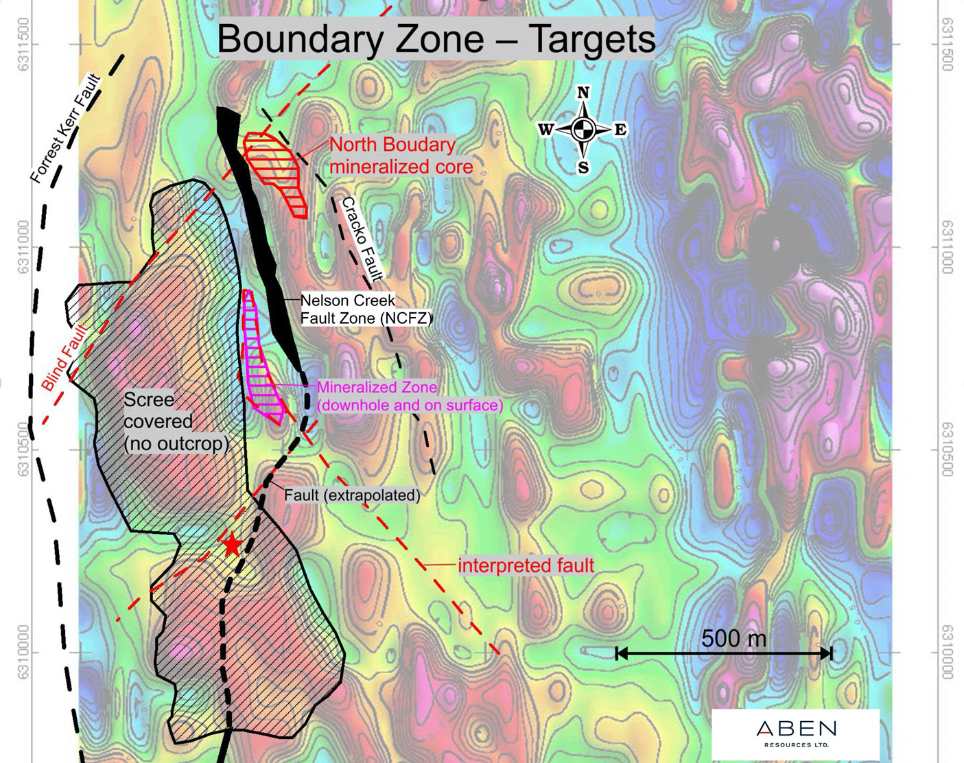
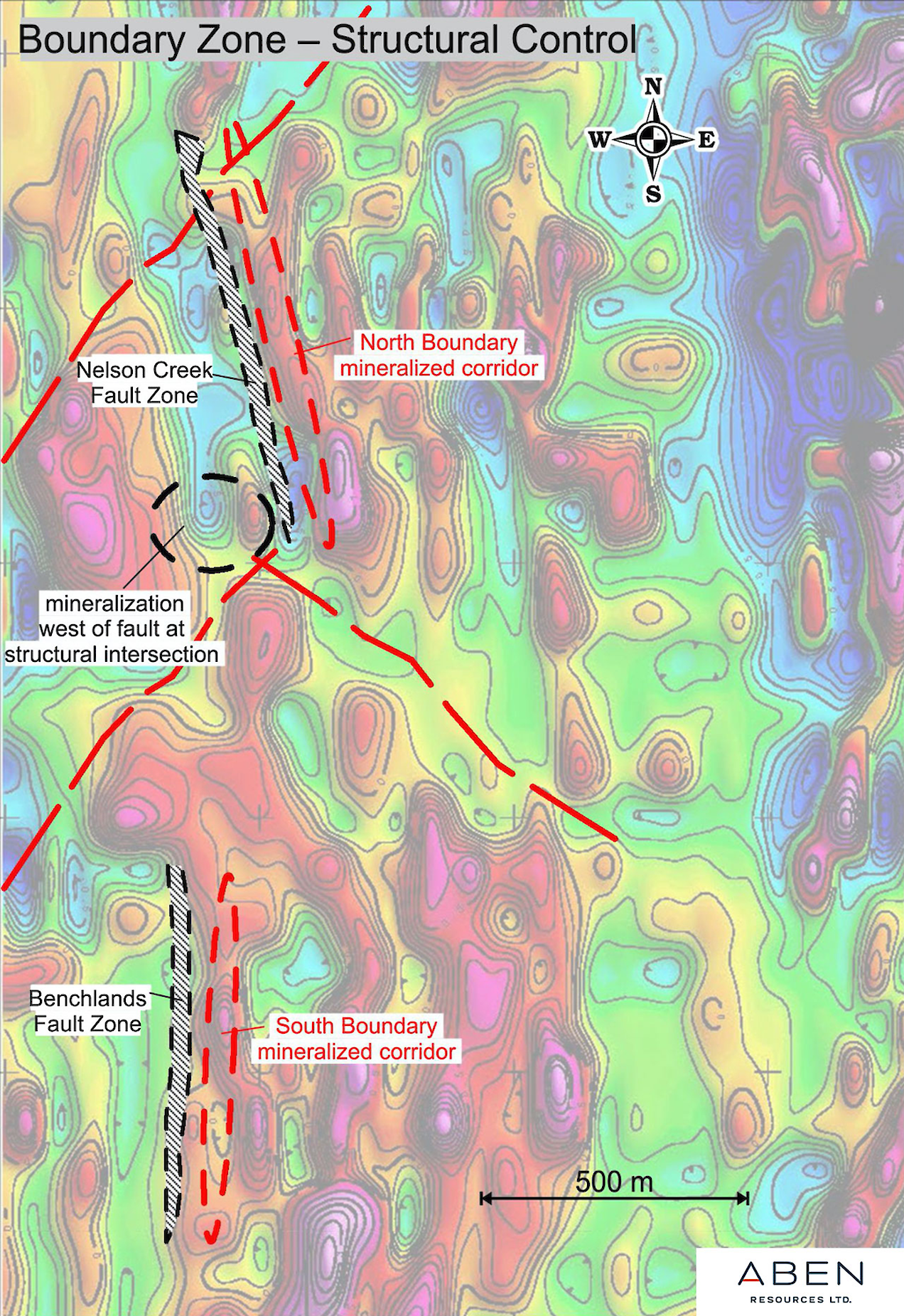
Recent exploration activity at Forrest Kerr has focused on two primary zones: the North Boundary zone which runs parallel to the Nelson Creek Fault zone, and the South Boundary zone, which runs parallel to the Benchlands Fault zone. The structural intersections between dominantly north-oriented fault zones and older northeast and northwest-trending faults are highly prospective for the discovery of precious metal mineralization.
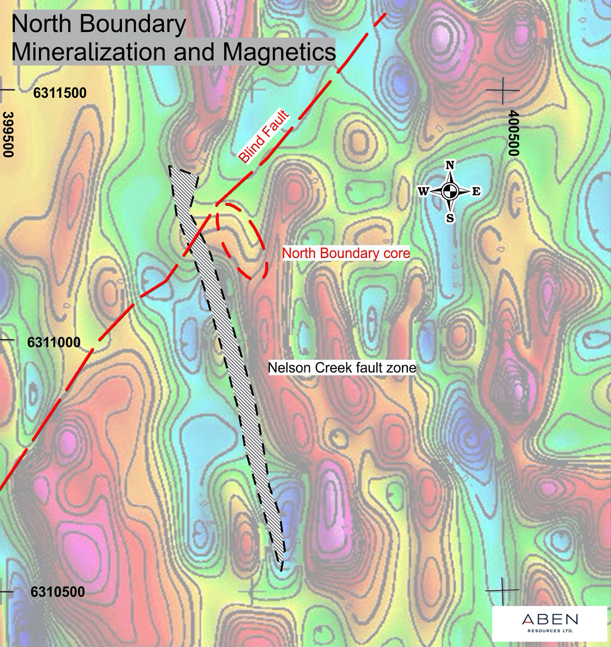
NORTH BOUNDARY
The main mineralized core at North Boundary is located at the intersection of the northeast directed Blind Fault and the northwest Nelson Creek Fault Zone (see red dashed ellipse). The strongest gold mineralization thus far discovered is along a southeast-northwest panel of Hazelton rock at the margins of a magnetic high.
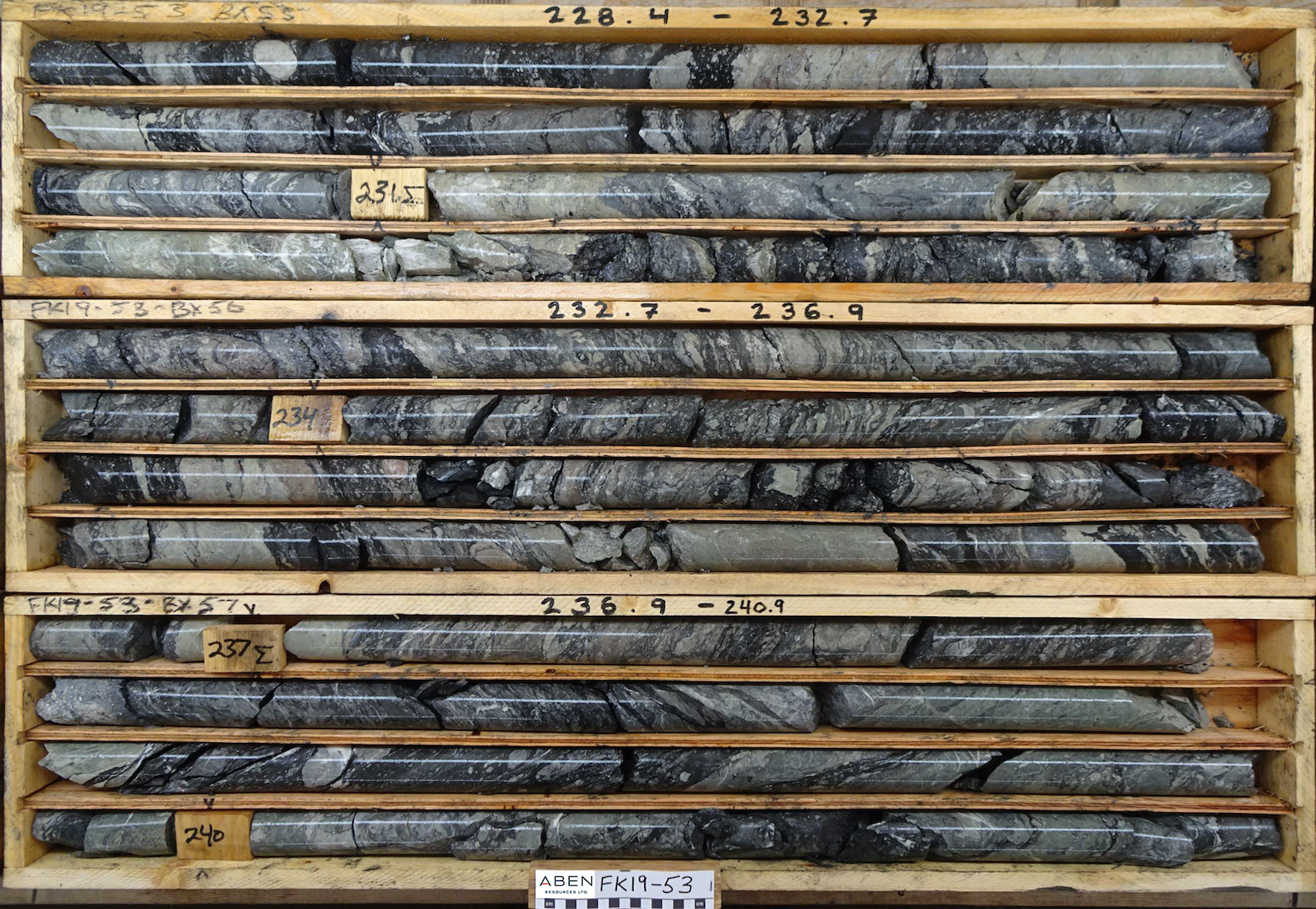
North Boundary Drill Results
- FK17-04: average of 0.26 g/t Au over 387.0m including 6.70 Au, 6.36 g/t Ag and 0.90 % Cu over 10 m
- FK17-05: average 1.20 g/t Au, 1.80 g/t Ag and 0.21% Cu over 122.0 m
- FK17-06: average 0.51 g/t Au, 1.03 g/t Ag and 0.10% Cu over 94.0 m
- FK18-10: multiple high grade gold horizons including 3.9 g/t Au over 13.0m, 22.0 g/t Au over 4.0m, 38.7 g/t Au over 10.0m and 8.2 g/t Au over 14.0m
SOUTH BOUNDARY
The South Boundary zone at Forrest Kerr contains gold mineralization associated with the Benchlands Fault, which parallels the Forrest Kerr Fault. The Benchlands Fault is poorly defined at surface toward the north due to scree cover but may be a southern extension of Nelson Creek Fault Zone found at North Boundary.

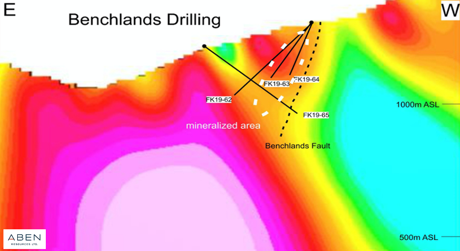
Drilling at the South Boundary zone has defined gold mineralization in a sub-vertical geometry (steep dip to East) that parallels the Benchlands Fault, including one assay value of 6.19 g/t gold. Drill holes placed over magnetic susceptibility image show gold mineralization (white dashed ellipse) is found between margins of magnetic high and Benchlands Fault Zone.
Rocks from the Benchland Fault zone are very similar in appearance and scale to those from Nelson Creek Fault Zone at North Boundary. Click to Enlarge
Drill Targets
The Hatched magenta area on the west side of Nelson Creek Fault Zone is a high priority target that combines strong surface and downhole polymetallic mineralization with only one drill hole through the zone. The area where the interpreted and extrapolated faults intersect is also highly prospective for gold discovery based on surface, downhole and geophysical indicators.